Seafloor Planner
Design and plan ocean bottom seismic surveys.
About Seafloor Planner
Seafloor Planner is a design and planning tool for ocean bottom node and cable surveys, used by major organisations around the world, and created in partnership with Engenius Software.
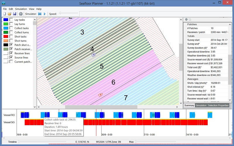
Seafloor Planner instantly shows the estimated completion time, vessel utilization figures, critical path and other useful information about an ocean bottom seismic survey.
Press “play” to view a simulation of the survey.
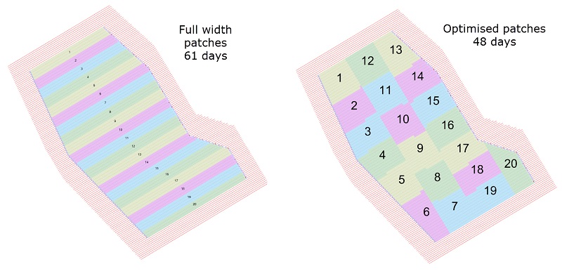
Use the patch optimizer to find the best way to divide patches across the survey, potentially saving days of survey time.
Alternately, manually adjust the configuration and compare – has a different receiver roll just saved four days of survey time? What is the effect of using different line spacing? Different turn patterns? Wider patches? More receivers? Which tasks are on the critical path and how can they be done faster?
Seafloor Planner enables comparison of different scenarios for these and many other factors, visualizing immediately how they affect the survey. See instantly whether the survey is shot-bound or receiver-bound, and how the inter-dependencies impact the survey duration, and adjust accordingly. Once a scenario has been modeled, it can be copied and pasted into Excel or other applications for comparison.
Seafloor Planner’s main marketing page is on the SurvOPT Software site, as it is sold as part of the Engenius Software seismic optimisation product range.
Latest releases:
Seafloor Planner 2.8.0: What’s New?
Seafloor Planner 2.8.0 includes a range of exciting new features, including multiple receiver vessels, a more comprehensive turn pattern optimiser, new lay and collect efficiency options, and new displays for battery life and receiver inventory shortfall.
Seafloor Planner 2.7.0: What’s New?
- New bathymetry features
- Bug fixes and usability improvements
Seafloor Planner 2.6.2: What’s New?
- New statistics
- Bug fixes and usability improvements
Seafloor Planner 2.6: What’s New?
- Support for coordinate reference systems using feet
- Periodic reports: Export statistics at selected intervals over the survey plan
- Optionally handle receivers in full lines, in rolling spread surveys
- Bug fixes and usability improvements
Seafloor Planner 2.5: What’s New?
- Receiver and source area polygons can now be loaded from shapefiles
- New receiver points CSV export available
- Bug fixes and usability improvements
Subscribe for news.
Subscribe to receive news and register to be involved in prototype testing.


